Geophysical Surveys Applied to Hydrogeology
Relevance of Geophysical Surveys in Hydrogeological Contexto
In hydrogeology, geophysical surveys are a valuable tool for the reconstruction of geological structures and for defining the relationship between permeable and impermeable formations.

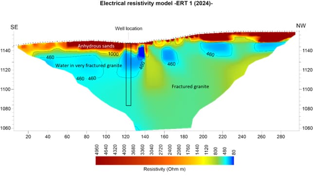
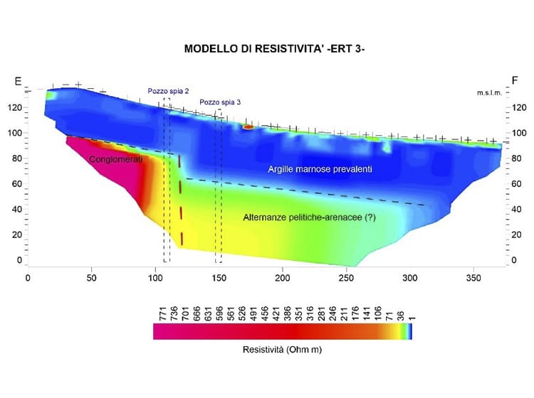
For this purpose, high-resolution seismic reflection surveys are particularly useful, as they allow investigations at significant depths. Geoelectrical surveys, including Vertical Electrical Soundings (VES) and multi-electrode configurations (Tomographies), not only provide lithological information, but often allow the direct identification of aquifer depths and geometries.
In hydrogeological studies, Time-Domain Electromagnetic (TEM) equipment is also used. These systems investigate the resistivity characteristics of the ground at great depths (up to over 600 m) with relatively small surface spacing, enabling the reconstruction of lithological stratigraphy and detection of potential shallow and deep aquifers.
Do you have a project?
Contact us for a consultation or for more information on our services
Contact us now

