Equipment for Geophysical Survey Measurements
Special attention is given to the quality of the equipment (machine fleet), whose reliability ensures the accuracy of the field data, a fundamental requirement for generating high-quality models. The company relies on internationally recognized manufacturers such as Guidelinegeo, Geometrics, Geotomographie, Lennartz, and IDS.

SEISMIC REFRACTION, REFLECTION AND MASW SURVEYS
- Modular seismograph 24-bit, Geometrics Geode x2 = 48 channels, unlimited expansion. High dynamic range (144 dB), acquisition bandwidth from 1.75 to 20,000 Hz, and 20-microsecond minimum sampling for high-resolution surveys.
- Vertical geophone arrays (4.5, 10 Hz Geospace; 14, 30, 100 Hz Mark Products).
- Horizontal geophone array (48), 10 Hz Geospace.
- 3D downhole acquisition system (Dual Down-Hole System – Geotomographie, 10 Hz, dual-sensor).
- LENNARTZ Seismograph (Model LE-3D/5S), ideal for H/V (Nakamura method); stable frequency response from 0.2 to over 100 Hz.
- SmartSolo IGU/BD-3C broadband nodal sensors, suitable for single-site H/V analysis and microtremor array methods (SPAC, ESAC, etc.).
SEISMIC SURVEY PROCESSING SOFTWARE
- SeisImage 2D – seismic refraction & tomography processing.
- Rayfract – tomographic seismic refraction modeling.
- OPTIM SeisOpt Pro – advanced tomography modeling.
- WinSeis – reflection seismic processing.
- WinSurf – surface wave (MASW) Vs profiling.
GEOELECTRICAL SURVEYS
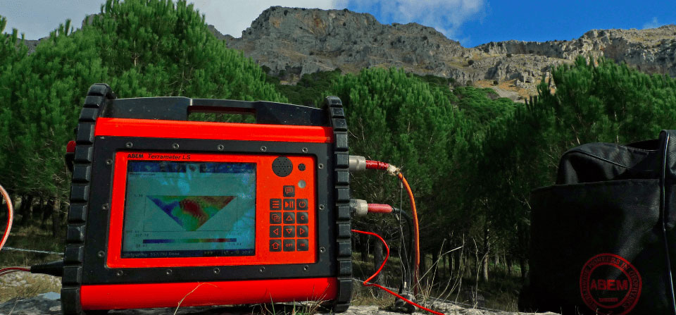
- ABEM Terrameter LS2 resistivity meter with 8-channel simultaneous acquisition, for resistivity, IP and SP measurements, integrated selector for 81 electrodes.
- Color-coded cables with 5 and 10 m spacing.
- Vertical Electrical Sounding cables up to 2000 m spacing.
LASER SCANNER
- Riegl 420i laser scanner for surveys from 2 to 1000 m, ~5 mm precision, up to 12,000 points/sec; integrated with Nikon D200 digital camera.
- RiscanPro software for topographic & architectural modeling, texturing, monitoring, and orthophotos.
GPR (GROUND PENETRATING RADAR)
- GSSI SIR20 two-channel radar with 200, 500, 900 MHz antennas.
- RADAN software for data processing.
- MALA GroundExplorer (450 MHz).
- IDS Stream DP multi-antenna GPR system.
ELECTROMAGNETOMETER
- Geophex GEM2 multi-frequency EM sensor, simultaneous acquisition up to 15 frequencies. Outputs: ppm, conductivity, magnetic susceptibility.
MAGNETOMETER
- Geometrics G-858 Cesium vapor magnetometer, single and gradiometric configuration, acquisition intervals from 0.1 sec to 1 hour, 0.01 nT sensitivity.
INCLINOMETER BOREHOLE MEASUREMENTS
- RST Instruments dual-axis servo-accelerometer inclinometer probe.
- Inclinasys software for data processing.
DRONES
- SenseFly Ebee fixed-wing drone with automated flight for photogrammetric surveys (RGB or NIR camera).
- SenseFly eXom VTOL drone for vertical/slope surface inspection (e.g., rock outcrops, walls, structures); captures visible and thermal images.
- DJI Matrice M200 RTK Multi-rotor Drone.
- DJI Matrice M300 Multi-rotor Drone.
- Post-processing software for orthophotos, point clouds, DSM, DTM, and isohypses.
Do you have a project?
Contact us for a consultation or for more information on our services
Contact us now